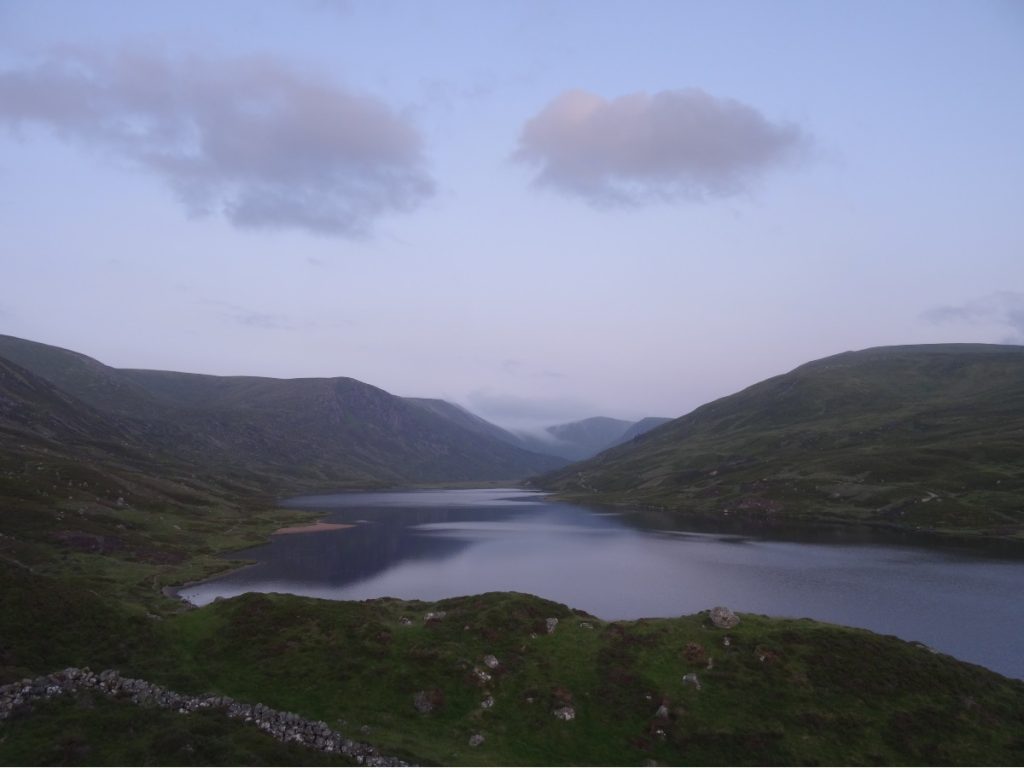
After pottering round Aviemore and stocking up on supplies, we headed east towards Braemar. I can’t remember exactly how Loch Callater came onto our radar, but it didn’t take long for us to find a way to fit it into our itinerary. Of all the lochs I’ve seen in Scotland so far, this is a strong contender for being my favourite. We parked the car at Auchallater, fed coins into the machine, and changed into our hiking clothes. (As it turned out, it was a popular spot for wild swimming so no one bats an eye when they see people changing between car doors.)
From Auchallater, it’s an easy 5km or so along ‘Jock’s Road’, a dirt track which runs alongside Callater Burn (above) to Loch Callater. Jock’s Road was an old droving route, used by herders to take their sheep from nearby Braemar to the market at Cullow. In 1885 the Glen Doll Estate (as it was then known – it’s now the Invercauld Estate) was bought by Duncan MacPherson. MacPherson immediately attempted to ban all public access to the land, putting the herders’ route along Jock’s Road under threat.
The Scottish Rights of Way Society (now ScotWays) contested their closure and the dispute made it all the way from the Court of Session to the House of Lords, who ruled in favour of the Society. This paved the way for the Local Government (Scotland) Act in 1894, which put public access rights in the hands of local authorities rather than landowners.
When the path forked, we veered left to reach Callater Stables. Sitting just back from the shore of Loch Callater, Callater Stables is a single-storey stone outhouse which is maintained by the Mountain Bothies Association and open to all.
We opened the door onto a sizeable living room area, with a raised platform in the far corner. Off to the right of the main entrance was a small bedroom with two bunks and rucksacks propped up against them. We dropped our stuff by the raised platform in the main room, and headed down to the loch. I just about managed a paddle in the shallows, but the water was way too cold for me to want to take a dip in it.

When we returned to the bothy, we met L and R from Liverpool. They hadn’t stayed in a bothy before, and stumbled upon this one in a copy of The Scottish Bothy Bible in Braemar. We spent a good half hour or so chatting before parting ways for bed.
We woke at our usual time the following morning, and were glad we had the main room as L and R were still asleep when we left at 08.30. I would’ve felt a bit awkward traipsing in and out of the main room if someone else were sleeping in it.
For Laurence’s birthday, we’d planned a route that would take in a trio of Munros north of Loch Callater: Carn an t-Sagairt Mòr, Carn a’ Choire Bhaidheach and Lochnagar. Already, the temperature was climbing, and the steady slope felt that wee bit harder than it really was in the heat.
On the approach to Carn an t-Sagairt Mòr, Laurence spotted a mountain hare which obligingly sat still for a moment before bounding off down the hillside. (Maybe it’s just me, but its bulging eye gives me the creeps!)
From Carn an t-Sagairt Mòr, we dropped down towards Carn a’ Choire Bhaidheach. A little further along, we spotted water tumbling down the hillside (below) and stopped to refill our bottles.
Beyond Allt na Da Chraobh Bheath, it was a gentle climb upwards to Carn a’ Choire Bhaidheach. We didn’t meet many walkers on the first leg of our route, but the path became noticeably busier towards Lochnagar as there is a shorter ascent to it from Spittal of Glenmuick.
There are a handful of small lochs between Carn a’ Choire Bhaidheach and Lochnagar, and for me this was one of the prettiest stretches of the route. There’s something magical about pools of water up in the mountains that I can’t quite put my finger on.
A kilometre or so further on, the path climbs steeply to Lochnagar. At this point, I should say we were both a bit flummoxed by the map, as there appeared to be a different peak just beyond Lochnagar that was higher (Cac Carn Beag). We’d been aiming for Cac Carn Beag, as this was marked with a viewpoint symbol on the map (and after ten kilometres, what’s another five hundred metres?), so on we went.
When we reached Cac Carn Beag, there was a stone indicator labelling the peak as Lochnagar. We were utterly baffled – but it later turned out that Lochnagar is deemed such a big mountain, its summit has its own name (Cac Carn Beag). Mystery solved!
We had lunch at the top of Cac Carn Beag, and watched the clouds roll in, swallow up neighbouring peaks, then lift again. Stomachs sated, we clambered down to the path and retraced our footsteps back to Loch Callater (skirting the edge of Carn an t-Sagairt Mòr this time, rather than going over the top).
If there’s one thing I’ve learnt about the Cairngorms National Park, it’s that when it’s hot, it’s hot. Borderline unbearably hot, as there’s very little to be had in the way of shade. We stopped at Callater Stables for a loo break (there’s a dry toilet in the lean-to opposite the bothy) and a sliver of shade, and then continued on to Auchallater. That last five kilometres felt more like ten, and we felt very relieved when we rounded the final bend and the car park came into sight.
We freshened ourselves up the best we could, and then headed into Braemar for cake at The Bothy. I opted for a slice of banana-fudge cake, while Laurence went for a wedge of the orange-poppyseed. With the afternoon wearing on and a shower becoming more tempting with every passing minute spent in the sun, we drove down to Braemar Caravan Park. We pitched the tent, showered (bliss!) and then walked back into Braemar for tea. Farquharsons did the job: a burger apiece with chips and onion rings, followed by cake (carrot for me, chocolate for Laurence) for pud.
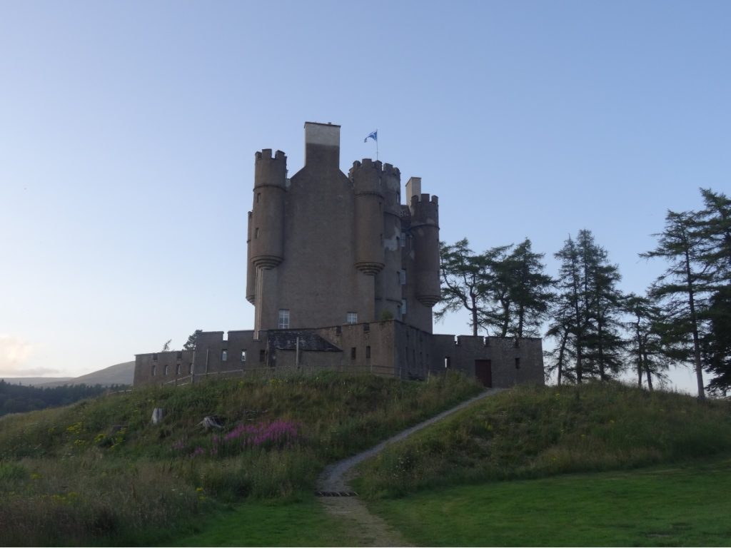
Before hitting the sack, we took a walk up Glenshee Road (which becomes Old Military Road beyond The Invercauld Arms) to see Braemar Castle. I enjoyed seeing the castle, but for me the best part of the detour was seeing some white rabbits (escapees from Alice’s Adventures in Wonderland, perhaps?) in the vegetable garden…

KNOW BEFORE YOU GO
- Parking | Auchallater car park cost £3 for a day ticket in July 2021; the machine only accepts coins. As we were staying overnight at the bothy and returning the following day, we bought a ticket for that day and left a note on the dashboard with our mobile numbers on it in case anyone came by the following day to check tickets.
- Maps and guides | Arm yourself with copies of OS Explorer OL52 (for the first leg) and OL53 (for the main chunk of this route) – and know how to read them.
- Distance | We split this over two days, and did the first leg from Auchallater to Loch Callater in the afternoon, and the Munros the following day – ending back in Auchallater. It’s 5.2km/3.3 miles from Auchallater to Loch Callater, with 132m of elevation gain. For the loop from Loch Callater up to Carn an t-Sagairt Mòr, Carn a’ Choire Bhaidheach and Lochnagar, and back to Auchallater, it’s 25.9km/16.2 miles with 973m of elevation gain.
- Bothies | We stayed at Callater Stables, a bothy on the western tip of Loch Callater. Many bothies are maintained by the Mountain Bothies Association (MBA). If you’re planning to stay at, or camp beside, a bothy, familiarise yourself with the Bothy Code before you go. For an overview of Scotland’s bothies and details of how to access them, I’d highly recommend Geoff Allan’s The Scottish Bothy Bible.
- Camping | We spent the last couple of nights of our trip at Braemar Caravan Park (£45 for a two-man tent for two nights, in July 2021).
- Misc. | If you’re passing through Braemar, I highly recommend a pit-stop at The Bothy for cake. (You can thank me later.)