We couldn’t stay near Hadrian’s Wall and not walk at least some of the Hadrian’s Wall Path. We’d had a taster of it the previous day, with short walks near Housesteads Roman Fort and Black Carts Turret, but we fancied doing one more walk before driving home.
We settled on a circular route from Twice Brewed – or was it Once Brewed? I’m afraid I don’t know for sure: our OS map had both villages marked on it, mere millimetres apart; Google Maps tells me it’s Once Brewed; and yet we only saw signs for Twice Brewed. Either way, if you stick ‘The Sill: National Landscape Discovery Centre’ into your preferred navigation app, you’ll end up in the right place. We crossed the B6318, and headed up a narrow lane to join the Hadrian’s Wall Path at Peel. (Coincidentally, the chunk of the Hadrian’s Wall Path that we’d chosen to walk was also part of the Pennine Way.)
After stopping to take a few photos of Steel Rigg and stuff our fleeces into our rucksacks (it looked overcast, but it was unbelievably muggy), we turned left towards Winshield Crags. At 345m, Winshield Crags is the highest point on Hadrian’s Wall: a good vantage point for the Romans… and beautiful views for visitors today.
Some might wonder how interesting a walk along Hadrian’s Wall could be, given you’re simply following a stone wall for miles on end. But for me, there was something indescribably cool about walking alongside a wall that once marked the frontier of the Roman Empire, and that has stood for the best part of two thousand years.
Just after Caw Gap, we came to the remains of Turret 41A. Along Hadrian’s Wall (or at least, along the small chunks we’d walked), English Heritage signs provided an insight into what the remains would have looked like, and been used for, in Roman times. This particular turret, so the sign informed us, would have been two or three storeys high, offering just enough space to shelter the soldiers who patrolled this section of Hadrian’s Wall.
Hadrian’s Wall’s reliable pattern of turret-turret-milecastle meant that as soon as you’d passed one turret or milecastle, another – complete with its own bite-sized history lesson – wasn’t far off. Cawfields, like the dozens of milecastles to its west and east, had a gateway through the wall, which enabled soldiers to control the movement of civilians to and from Britannia and send patrols out beyond the frontier.
Cawfields sits at the top of a steep slope overlooking Hole Gap, a low-lying patch of land immediately to the west and a potential weak spot in the wall. I suspect Cawfields’ strategic position was enough to make any would-be invaders think twice about attempting to clamber over the wall.
On the slope below the milecastle, there were dozens of sheep. At first, it looked like an idyllic pastoral scene. When we got closer – the path cut down the slope; we weren’t meandering through a herd of noisy sheep by choice – we realised they were bleating noisily, and there wasn’t a lamb in sight. We’d been watching Clarkson’s Farm (which I highly recommend) before this trip, and it suddenly struck us that there probably had been lambs until very recently – and that they’d likely been taken away to be slaughtered.

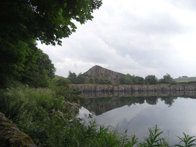
Continuing down the path, we soon reached Cawfields Quarry. Hadrian’s Wall ran along the scarp face of the Whin Sill, between Walltown and Sewingshields. Sadly, quarrying of the whinstone – a hard, black rock which was used to surface roads – both here at Cawfields and at Walltown destroyed sections of Hadrian’s Wall, and today only a short (read: borderline miniscule. It was barely discernible from the path) section remains on the top of the cliff above Cawfields Quarry. Darting about in the grass around the quarry were tons of teeny-weeny frogs, each no bigger than a fingernail.
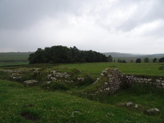
As we approached the remains of Aesica Roman Fort (below), the first drops of rain began to fall. What began as a drizzle quickly became a downpour, and had us scrambling to pull on waterproofs before we were soaked to the skin. We walked back to Cawfields Quarry as quickly as we could, and joined some other walkers sheltering in the small covered area beside the toilet block.

Fortunately, the worst of the rain passed fairly quickly. We followed the Roman Military Way – which runs roughly parallel to the Hadrian’s Wall Path – for the next couple of kilometres, and rejoined the Hadrian’s Wall Path at Caw Gap. A little further along the path, we bumped into an older couple and for one reason or another got chatting. She had walked the Hadrian’s Wall Path a few years ago (and was quick to recommend it) and they were both doing the West Highland Way (which we’d walked three summers ago) in a couple of weeks’ time. We then dropped down to Winshields via Lodhams Slack, and walked the last kilometre along the road to return to Twice Brewed.
We stopped off at The Twice Brewed Inn – which bore amusing signs including ‘In loving memory of a sunny day on Hadrian’s Wall’ on the wall beside the entrance – for a drink and a bowl of chips, and then headed home.
KNOW BEFORE YOU GO
- Parking | We parked at The Sill in Twice Brewed (£3 for 3 hours, and £1 an hour thereafter to a maximum of £5 for the day), but you could also start this circular route from the smaller car parks at Steel Rigg or Cawfields Quarry.
- Maps and guides | OS Explorer OL43 is all you need for this route.
- Distance | 13.05km/8.2 miles; 398m of elevation gain.
- Misc. | Greencarts Campsite and Bunkhouse, near Walwick, is a great option if you’re exploring the area on a budget; in July 2021, a tent pitch was £8 per adult per night.